



At a glance
- Victoria has over 60,000 ha of blue carbon habitat, but around 75% is degraded, creating major restoration opportunities for blue carbon restoration.
- Restoring tidal flows and enabling managed retreat could create up to 124,000 ha of additional blue carbon habitat.
- Pilot projects are restoring mangroves, seagrass and saltmarsh, helping build coastal resilience across the state.

Victoria’s blue carbon: where restoration could matter most
The Victoria's Blue Carbon Statement outlines the Victorian Government's commitment to maintaining and restoring blue carbon ecosystems through partnerships with Traditional Owners, land managers and communities. It provides a strategic framework for expanding restoration efforts, improving ecological connectivity, and leveraging carbon markets and other finance mechanisms to support long-term coastal ecosystem management.
The Victorian coast includes seagrass meadows, saltmarshes and mangroves, known as blue carbon habitats, which draw carbon from the atmosphere and lock it away. They also protect shorelines, filter water, nurture fish and shelter threatened wildlife. The report Mapping Victoria’s Blue Carbon, released by the Department of Energy, Environment and Climate Action (DEECA) in September 2023, sets out where these habitats are, how healthy they are and where restoring them would deliver the most.
Mapping blue potential
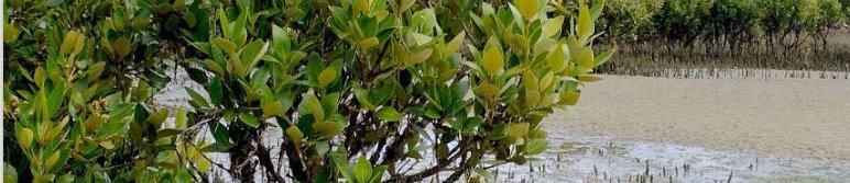
Victoria has more than 60,000 hectares of blue carbon habitat, mostly in Port Phillip Bay, Western Port and Corner Inlet. Seagrass makes up the largest share (about 42,800 ha), followed by saltmarsh (about 13,300 ha) and mangroves (about 2,300 ha). Corner Inlet is home to the world’s most southerly mangroves.
The 2023 report found that only around a fifth of this habitat is in a natural state. Levees, grazing and other land changes have disturbed much of the rest, and about a fifth has collapsed entirely. More than 16,000 ha is also predicted to be lost to erosion and sea level rise, with seagrass the most affected.
Finding the best places to restore
The mapping, built on research by Deakin University, scored habitat on its carbon storage and its wider benefits: coastal protection, biodiversity, fisheries and water quality. The areas that combine high benefits with poor condition are flagged as high-potential restoration sites.
The report also looks at four practical ways to restore or expand saltmarsh and mangroves:
- reinstating tidal flows, for example by removing levees
- controlling grazing
- making room for habitat to retreat inland as seas rise
- tackling complex water-flow problems at a handful of large sites.
- DEECA’s Mapping Blue Carbon page
- the maps on CoastKit
Note: These are statewide maps, so they guide planning rather than replace local assessment. They don’t yet account for cost, landholder agreement or approvals, and they need local data and Traditional Owner leadership before any work begins.
the storymap
The Blue Carbon in Western Port and Eastern Port Phillip Bay StoryMap highlights the significant carbon storage and coastal protection benefits provided by the region's mangroves, saltmarshes and seagrass meadows. It presents research identifying opportunities to protect and restore these ecosystems to deliver climate, biodiversity and coastal resilience benefits.
To cite:
This case study was prepared by NCCARF.
Please cite as: NCCARF, 2026: Blue carbon habitat restoration in Victoria. Case study for CoastAdapt, National Climate Change Adaptation Research Facility, Griffith University, Gold Coast.