You are here
A bird in the hand
At the Climate Adaptation conference in Adelaide this year, a Tasmanian coastal management decision tool was presented that could help local land managers in other States manage and protect their coastal biodiversity.
‘We want to see if others around Australia can add it to their management repertoire, so they don’t need to reinvent the wheel, and can drop in their own data and start using it,’ says the project leader, Dr Eric Woehler from BirdLife Tasmania.
The management tool was developed by BirdLife Tasmania, the Tasmanian Department of Primary Industries, Parks, Water and Environment, and the University of Tasmania to address the impact of sea-level rise on coastal birds and plants and to help prioritise conservation strategies for coastal assets.
‘Coastal managers and community groups are faced with the dilemma of how to prioritise their efforts,’ Eric says. ‘This decision tool uses a set of GIS decision processes. Land managers put in data about the distribution of shorebirds and plant communities, and the tool looks at how those values are threatened by sea-level rise and the potential loss of coastal habitats.’
The tool simplifies a complicated set of information about sea-level rise, beach type, and location of natural assets, down to three potential outcomes. One is that the site will simply disappear due to sea-level rise, due to a cliff or infrastructure preventing the beach from retreating inland as sea level rises. Another is that the site will be displaced inland and upward if there is capacity for the system to move. The third possible outcome is that the site could survive in its current form and location into the future.
‘The third category of sites are identified as refugia,’ Eric explains. ‘All else being equal, refugia would be able to support current values in future. For refugia, it is recommended that land managers minimise activities that disturb or threaten natural values to ensure the maximum likelihood for the refugia to persist.’
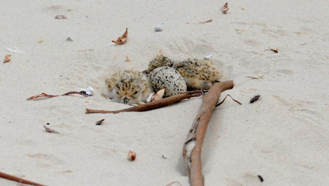
Eric began surveying beaches in 2000/01, collecting data on coastal plants and beach-nesting bird species such as hooded plovers and pied oystercatchers. ‘By summer 2013/14, we had a snapshot of Tasmanian shorebirds for 118 coastal areas. We had to draw a line in the sand – literally and figuratively – for use in the original assessment, but it is an evolving assessment process and we have now surveyed 350 beaches, with surveys continuing into the future.’
The Tasmanian tool represents the first time such an approach has been undertaken in Australia, and Eric hopes it will be used in other States. ‘At the end of the process, a local land manager needs to make a subjective assessment about which beaches to prioritise.’
More information:
Video of Eric Woehler at the National Climate Adaptation Conference 2016
CoastAdapt case study: Impact of sea level rise on coastal natural values in Tasmania
Is natural heritage in your area threatened by sea-level rise?
How do you prioritise actions to protect coastal values?
cd45cdl105vnyg5x.png