You are here
See the sea on CoastAdapt
The CoastAdapt beta version was launched this week. An exciting and novel aspect of CoastAdapt is new mapping and interactive visualisation.
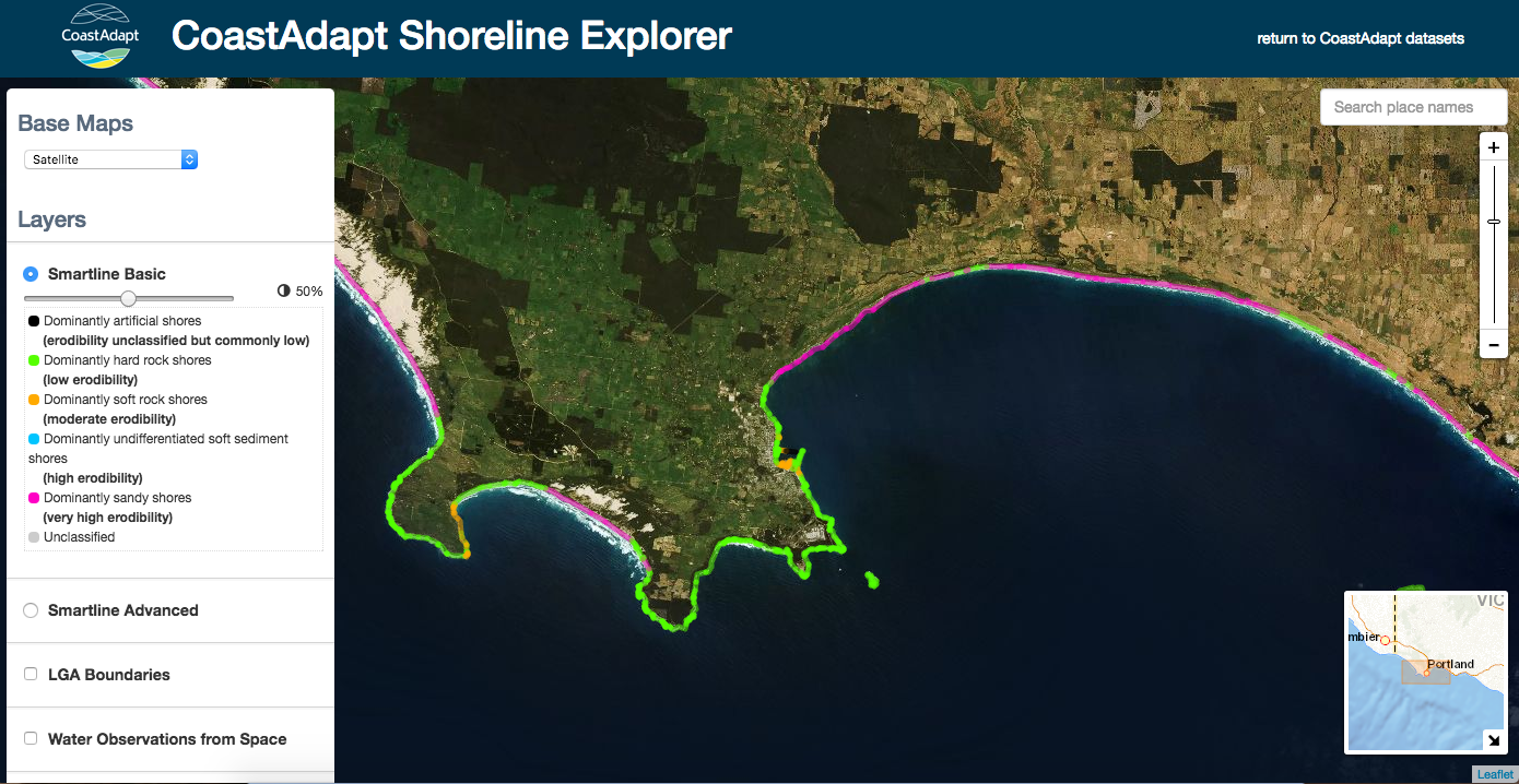
The interactive visualisation tool, Shoreline Explorer, presents maps in GIS layers to provide a user-friendly way to obtain information about coastal risk.
‘It’s a picture paints a thousand words approach,’ says Jo Mummery, an NCCARF senior research fellow in coastal adaptation. ‘Maps convey a lot of information quickly, in a way people can readily grasp.’
The easy-to-use, interactive tool enables people to identify parts of their coastline that may be unstable or subject to erosion. In addition, maps are provided of inundation for three future sea-level rise scenarios targeted to local government areas. ‘It really is a step forward in tailored information for all coastal decision-makers,’ says Jo.
‘The mapping builds on the great work already invested in by the Australian and State Governments,’ says Jo. ‘The inundation mapping and visualisation draw on high-resolution, gold standard national and state elevation data sets. We are aiming to provide good information to help all local governments make a first pass at identifying their areas at risk.’
CoastAdapt can also be used as communication and engagement tool, enabling local councils to communicate areas of risk to communities.
What the tool cannot do is inform detailed investment decisions. ‘These tools help point to where more detailed knowledge may be required if there is a significant risk identified,’ says Jo.
Other parts of CoastAdapt that will provide guidance to councils include methods to identify at-risk hotspots, how to build a business case for adaptation, and monitoring and evaluation in adaptation. You can use the tool now at https://www.nccarf.edu.au/CoastAdapt-beta-release!
What aspects of CoastAdapt do you find the most useful?
What feedback can you share about using the CoastAdapt tool?
More info: https://www.nccarf.edu.au/CoastAdapt-beta-release
rti569af2vamkgtq.png